May 18th
Start&Finish: Musashi Yokote station to Higashi Agano station
The weather: High 28 Low 17
Outfit/Equipment: dry tshirt, light hiking trousers, gloves, hat, hiking shoes, 1L water.
Map: We took this map along for reference but took a different route up from Musashi Yokote station
Crowds: No one for the first half, then a few more hikers and lots of trail runners after Kamakitako
Time: 9:30 to 2:30
Difficulty: 29,000 steps, 184 flights climbed.
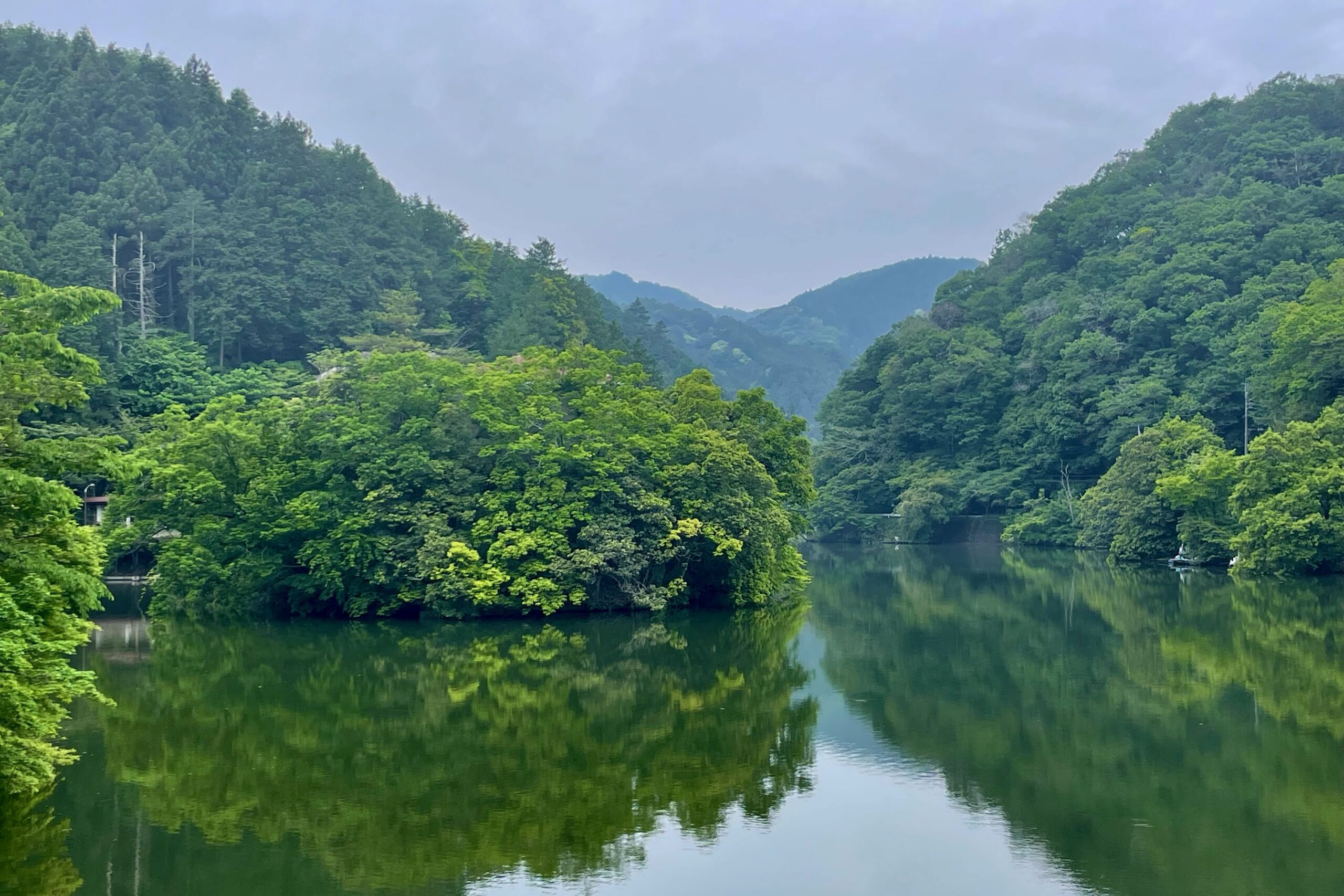
Yesterday was very rainy and I didn’t feel like climbing a high mountain, so we decided to go back to Kamakitako, which I loved when we visited in the Autumn. We’ve walked round this area several times now so we decided to take a less frequented route up from the station. You have to turn left and walk along the road quite a way until you get to the Chonenji shrine (長念寺). There’s a sign there and you walk through the shrine to get to the trail. It winds its way up through the temple grounds then into the mountains proper. There was no one else on the trail and the signs were very hit and miss. First we headed for Mt. Atagoyama (愛宕山) and then Mt. Suisho (水晶山) then Mt. Fukuzawa (深沢山) and then things went a bit wrong. We followed the path to Nishi Fukuzawa when we should have headed to Higashi Fukuzawa. It was a long, slippery slope with a rope to let yourself down and only about half way down did we realize we’d gone wrong and had to slog all the way back again.
After that we took a little more care and once back to our initial mistake we then headed towards Kitamukijizo (北向地蔵) where many different trails meet. It was a long way and by the time we finally reached the crossroads I was all for heading back to the station. We pressed on to the lake though and I’m glad we did as it was lovely. The going is also much easier from the crossroads down to the lake, which helped.
Somehow we managed to hit a trail run, just as we had last time we visited the lake. Either there are a lot of trail runs or we’re just really lucky. There were people staggering past us who had run 150km over two days. The mind boggles. The paths from the lake onwards were all very narrow which made passing difficult. We tried our very best to give the poor runners right of way and thankfully we got through without incident.
From the lake we intended to walk round to Ebigazaka (エビが坂) before heading down to Yugate (ユガテ) but someone, mentioning no names, insisted on a side road that took us back down to the path we’d just walked up. I’m not complaining though as it cut out a big chunk of the walk and I was getting pretty tired by this point. So instead of Ebigazaka we ended up going back to Kitamukijizou, then on to Yugate along a very slippery, muddy and narrow pathway and from there, on to the station via Fukutokuji shrine (福徳寺).
It was a long walk with the mud making the going particularly slippery, but there were none of the endless slogs up or down which you often get with a higher mountain, so it was a nice change.


Discover more from Nature Escapes
Subscribe to get the latest posts sent to your email.